Artifact Spotlight: Chart of Narragansett Bay, 1832
---Amy King, Curatorial Volunteer
Narragansett Bay has long been considered a suitable location for naval installations. In 1764, the Admiralty of the British Navy ordered a survey of the bay and the town of Newport to determine the area’s suitability as a potential naval base. Charles Blaskowitz, a surveyor under Samuel Holland, produced a series of surveys of the area dating from 1764 to 1775. The onset of the Revolutionary War and subsequent independence of the United States halted plans by the British to establish a naval base in Newport. The United States Navy bypassed Newport as a suitable location for ship-building in 1799 but a small station and hospital were located here briefly in the early 1820s. Some years later, in February 1832, the United States Congress ordered another survey of Narragansett Bay in order “to ascertain the practicability and expediency of establishing a naval depot therein.”
The new interest brought together a group of naval officers to survey the bay and surrounding areas in June of 1832. Captain Alexander S. Wadsworth, led Lieutenants Charles Wilkes, Thomas Gedney, George Blake, and Passed Midshipmen William Ward and Ralph Semmes on the six-month operation. The group ultimately produced the first systematic survey of the bay since the 1770s. Secretary of the Navy Levi Woodbury submitted the report to Congress on December 20 but no immediate action was taken.
Almost thirty years later, the U.S. Naval Academy was relocated to Newport for the duration of the Civil War. Renewed interest in a permanent installation at Newport, generated by the academy's move, soon influenced the establishment of the Naval Torpedo Station (1869), Training Station (1883), and Naval War College (1884) to the city by the sea.
Last November, the museum acquired an original copy of the chart with funds generously provided by the Naval War College Foundation. The map is engraved by W.J. Stone and consists of four separate pages which when joined together reveal the shores and depths of Narragansett Bay. The map is extremely thorough; detailing shoreline topography, various islands in the bay, vegetation, marshes, lighthouses, ferry landings, as well as the towns of Newport, Bristol, and Wickford. It even contains the second earliest published illustration of the old Newport Poor House on Coasters Harbor Island. The structure, built in 1819, became the original site of the Naval War College in 1884 and now hosts the museum. This new treasure of the museum's collection is a significant example of the Navy's long interest in the area. Plans are underway to exhibit the entire chart in the Early Naval History of Narragansett Bay Gallery.
A full copy of the chart, from the Harvard Map Collection, can be fully explored here.
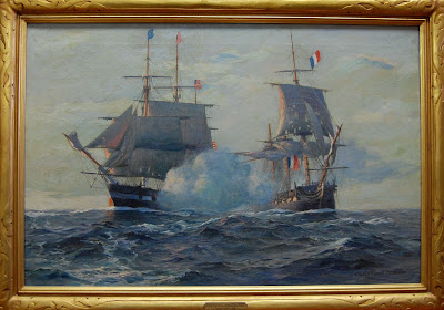
Incidently, members of the 1832 survey group went on to have distinguished naval careers. George S. Blake was Superintendent of the Naval Academy when the Civil War started. Under the command of Thomas Gedney, the brig Washington captured the slave ship Amistad in 1839. Ralph Semmes resigned his commission during the Civil War and commanded two Confederate commerce raiders, CSS Sumter and CSS Alabama. Charles Wilkes later led the United States Exploring Expedition from 1839-1842 and, in command of USS San Jacinto during the Civil War, stopped the British mail steamer Trent and removed two Confederate diplomats from her decks. The 1861 incident set off a near diplomatic crisis between the United States and Great Britain.
Museum Purchase 2011.23.01
Narragansett Bay has long been considered a suitable location for naval installations. In 1764, the Admiralty of the British Navy ordered a survey of the bay and the town of Newport to determine the area’s suitability as a potential naval base. Charles Blaskowitz, a surveyor under Samuel Holland, produced a series of surveys of the area dating from 1764 to 1775. The onset of the Revolutionary War and subsequent independence of the United States halted plans by the British to establish a naval base in Newport. The United States Navy bypassed Newport as a suitable location for ship-building in 1799 but a small station and hospital were located here briefly in the early 1820s. Some years later, in February 1832, the United States Congress ordered another survey of Narragansett Bay in order “to ascertain the practicability and expediency of establishing a naval depot therein.”
 |
| Detail of 1832 chart showing Coasters Harbor Island and one of the earliest illustrations of the Newport Poor House. |
Almost thirty years later, the U.S. Naval Academy was relocated to Newport for the duration of the Civil War. Renewed interest in a permanent installation at Newport, generated by the academy's move, soon influenced the establishment of the Naval Torpedo Station (1869), Training Station (1883), and Naval War College (1884) to the city by the sea.
Last November, the museum acquired an original copy of the chart with funds generously provided by the Naval War College Foundation. The map is engraved by W.J. Stone and consists of four separate pages which when joined together reveal the shores and depths of Narragansett Bay. The map is extremely thorough; detailing shoreline topography, various islands in the bay, vegetation, marshes, lighthouses, ferry landings, as well as the towns of Newport, Bristol, and Wickford. It even contains the second earliest published illustration of the old Newport Poor House on Coasters Harbor Island. The structure, built in 1819, became the original site of the Naval War College in 1884 and now hosts the museum. This new treasure of the museum's collection is a significant example of the Navy's long interest in the area. Plans are underway to exhibit the entire chart in the Early Naval History of Narragansett Bay Gallery.
A full copy of the chart, from the Harvard Map Collection, can be fully explored here.
Incidently, members of the 1832 survey group went on to have distinguished naval careers. George S. Blake was Superintendent of the Naval Academy when the Civil War started. Under the command of Thomas Gedney, the brig Washington captured the slave ship Amistad in 1839. Ralph Semmes resigned his commission during the Civil War and commanded two Confederate commerce raiders, CSS Sumter and CSS Alabama. Charles Wilkes later led the United States Exploring Expedition from 1839-1842 and, in command of USS San Jacinto during the Civil War, stopped the British mail steamer Trent and removed two Confederate diplomats from her decks. The 1861 incident set off a near diplomatic crisis between the United States and Great Britain.
Museum Purchase 2011.23.01
Comments
Post a Comment